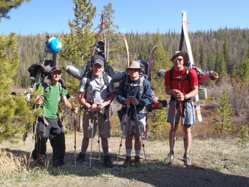
members of group: Sam Jordan, Ben Jordan, Joel Paula, and Zach Taylor
Kings Peak is the highest peak in Utah. It sits deep in the Uintah range. The Uintah range runs east to west, just south of the Wyoming border, east of the Wasatch range and Salt Lake City, and west of the Colorado border. Not a single ski resort penetrates the range. No road crosses the range year round. Approaches are long and the wilderness is the most remote that Utah has to offer. The easiest way to climb the mountain requires 28.8 miles of hiking and 4100' elevation gain.
I had had my eyes on the Uintah's for a while and the highest peak in the range made sense for my first foray into the area. Joel, Sam, Ben, and I had planned several weeks of skiing in the Tetons and decided Kings would be a good warm up on the drive up. We left Avon on the evening of the sixth, drove into Wyoming, camped, and then drove I80 west through Rock Springs on the morning of the 7th. We cut south a little past Rock Springs and made our way back into Utah to reach the trailhead for Kings.
This is the only way to get to the Henry's Fork trailhead, the easiest access point to Kings peak. The only other way to get to Kings is via Yellowstone Creek on the south side of the Uintahs through Duchesne, Utah. This approach is several miles longer still than the Henry's Fork approach.
photo-from left to right; Joel Paula, Sam Jordan, Zach Taylor, and Ben Jordan. photo by Sam Jordan, 2012.
We got up on the morning of the 7th, drove to the trailhead, and began to pack our gear. The trailhead was bare of snow and we figured we would be walking for quite a ways so we shouldered all our touring gear as well, and began the long hike in to the base of Kings. The trail in is long but gains very little elevation. We made our way up and camped about 5.5 miles in, right where snow line began. Ben had been sick for several days and announced that he was going to hike out the next day instead of trying for the summit. The rest of us felt good.
We knew we would have a long day ahead of us the next day (about 16-17 miles) so we made some mountain houses and went to bed early. We got up early on the 8th and began skinning up from base camp. The skinning lasted about half a mile before snow disappeared again and we had to shoulder our gear and hike a couple more miles into the base of Kings. Eventually we were able to start skinning again.
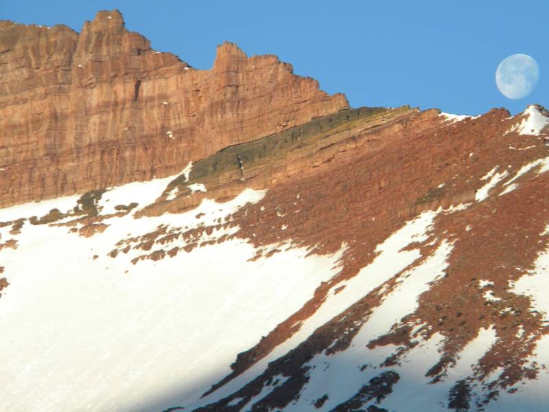
photo- The moon over the Uintahs. photo by Zach Taylor, 2012.
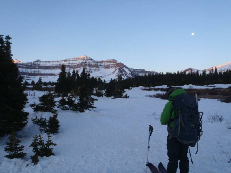
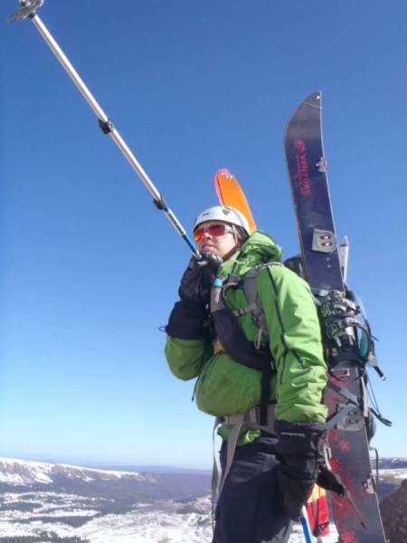
photo- Zach Taylor skinning towards Kings. photo by Sam Jordan, 2012.
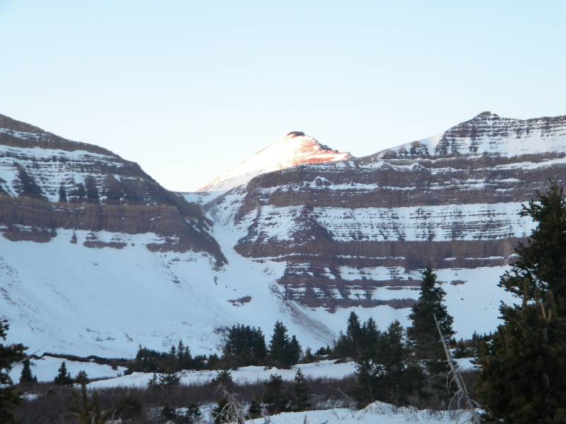
We made our way up to the base of Kings. The standard route during the summer curves around the north facing cirque that rings in the head of Henry's Fork basin, over a pass, and then accesses Kings. My guidebook warned summer hikers about trying to scramble up a steep chute full of loose rock that has more direct access to Kings. I read this and predicted that this "dangerous" route would probably not be so dangerous with snow in it. This chute is north facing and goes directly up the middle of the cirque that rings in the head of Henry's Fork basin. We looked up at it and decided it looked good.
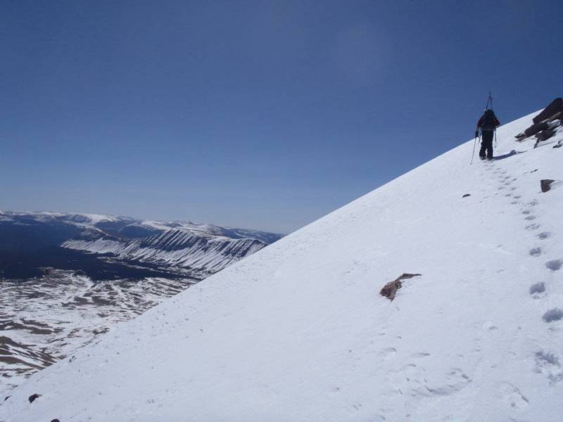
photo-Zach Taylor pointing towards Kings peak. photo by Sam Jordan, 2012.
There is a tiny, unnamed lake that sits at the base of the chute and we stopped for a few minutes to eat some breakfast and enjoy the sunrise over the Utah high country.
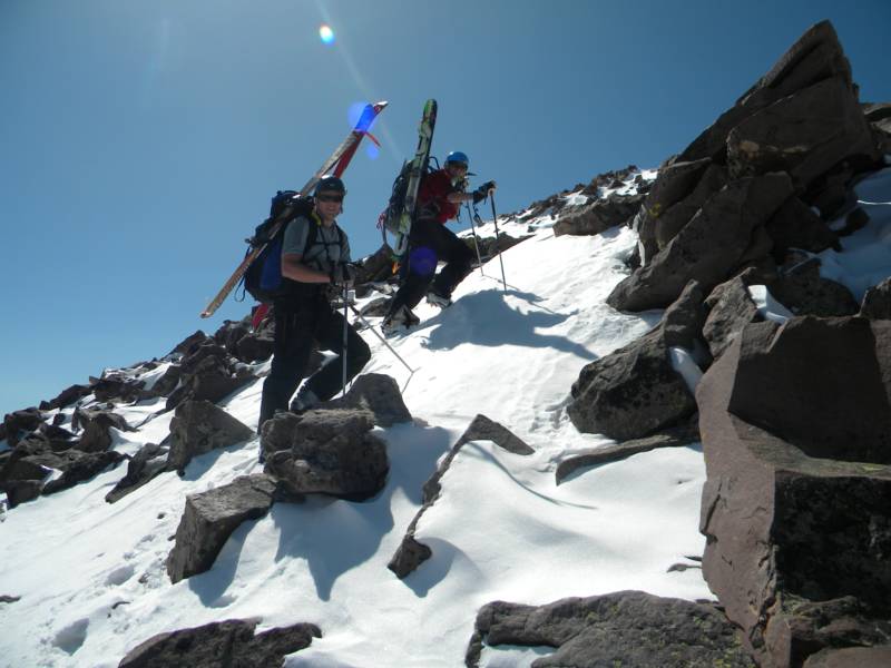
After a bit, we donned helmets and crampons, grabbed axes and began the climb up the chute to gain access to the northeast face of Kings. We hugged the climber's left side most of the time to avoid any potential roackfall hazard through the middle of the chute. No rock fell in this deeply inset, shaded area. The chute was between 35 and 40 degrees in pitch and the snow conditions were excellent for cramponing. We made good time up this section of the climb. There were several ski tracks going down the chute too from several days prior when another party skied the line.
The very top was melted out and rocky so we had to scramble over a few rocks to top out. It had still been cold and shady in the north facing cirque but as soon as we topped out the chute we were greeted with warmth, sun, and views of the northeast face of Kings. None of us had ever been into the Uintahs before and it was quite a treat as we took in views of this large, remote mountain range.
The northeast face of Kings was bathed in sunshine and snow became a bit sticky as we made our way up the northeast face. I did not measure with an inclinometer but if I had to guess I would have to say the northeast face was somewhere between 25 and 35 degrees the whole time. It was pretty easy snow climbing but enjoyable and very scenic.
We climbed up the face for a bit and then gained the ridge and continued to hike. We enjoyed good conversation on the origin of species, natural selection, and evolution in the heart of Mormon country as we made our way up this beautiful mountain. Sam has a degree in forest biology and works for the forest service and I am attending school for a double major in Neurobiology and nursing
photo- Joel climbing up the chute in the north cirque of Henry's Fork. photo by Sam Jordan, 2012
photo- Zach Taylor (left) and Joel Paula (right) looking out over the Unitahs. photo by Sam Jordan, 2012.
so our viewpoints on the subject were very similar. We are both atheists and are very science minded so we enjoyed discussing the facts and being in fundementalist country, were inspired to poke some fun at people who actually think the world is 5 or 6 thousand years old (namely the Mormons of Utah).
Time dragged on and our conversations turned to food. Joel is a chef and I worked in restaurants for almost ten years before returning to school to pursue a career in the health care industry. Joel knows a lot about food and we talked service industry and food for quite a while.
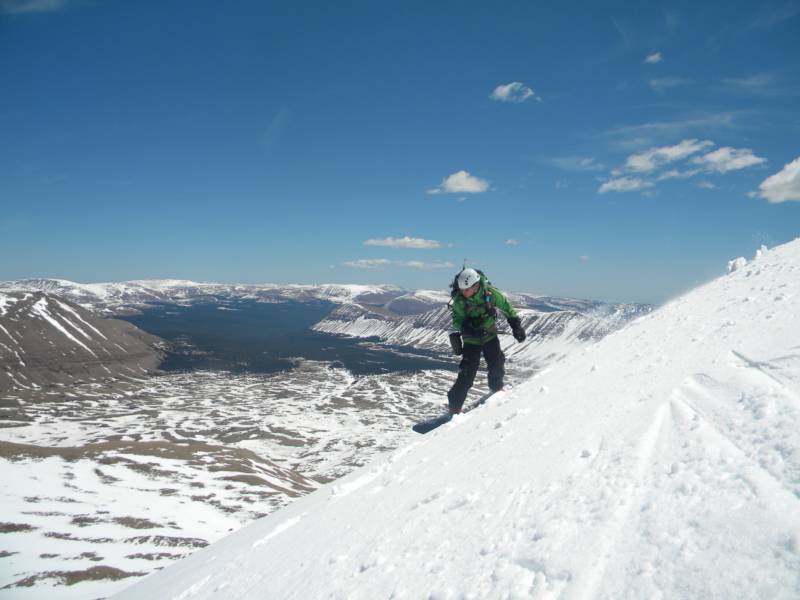
photo- Joel Paula climbing up the northeast face of Kings. photo by Sam Jordan, 2012.
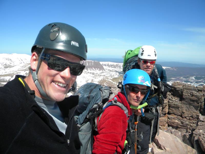
photo- Sam Jordan (left) and Joel Paula (right) climbing up Kings peak. photo by Zach Taylor, 2012.
We finally reached the false summit and thought we were pretty close. Descents between the false and main summit did not look promising so we dropped our skis/boards and continued scrambling along the ridge towards the true summit. Time dragged on. Conversation dwindled as we tired a bit and were just focused on getting to the top. It was still much longer than it looked and it took us about forty five more minutes to make it to the summit. It was worth it though. The views were awesome. We could see the southern part of the Wind River range to the north and the Wasatch range to the west.
photo- from left to right; Sam Jordan, Joel Paula, and Zach Taylor on the summit of Kings Peak, 2012.
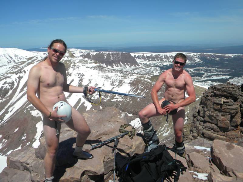
While we were hanging out on the summit Sam decided to take off his clothes for a photo op on top of Utah and when genius occurs one must follow suit so I took of my clothes as well. We bared our earthly souls and paid our respects to Mormons while enjoying the views from the highest point in Utah and left a premanent scar in Joel's vision as we made him take pictures...hehehe
It was fun but all good things must end.....and we were itching to make some turns. We put our clothes back on and made our way back down to the false summit where our glise gear awaited. We strapped in and dropped in one at a time enjoying corn turns down the northeast face of Kings.
photo- Zach Taylor (left) and Sam Jordan (right) on the summit of Kings peak,the highest peak in Utah. photo by Joel Paula, 2012.
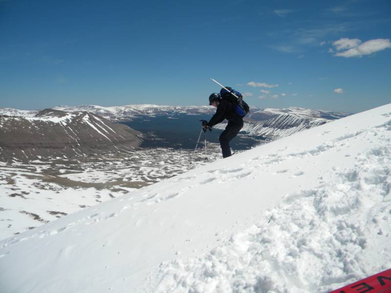
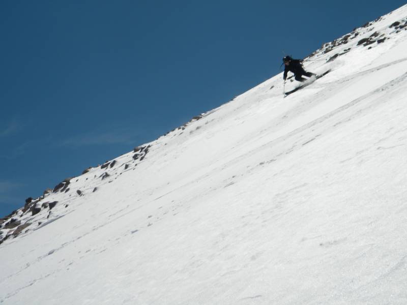
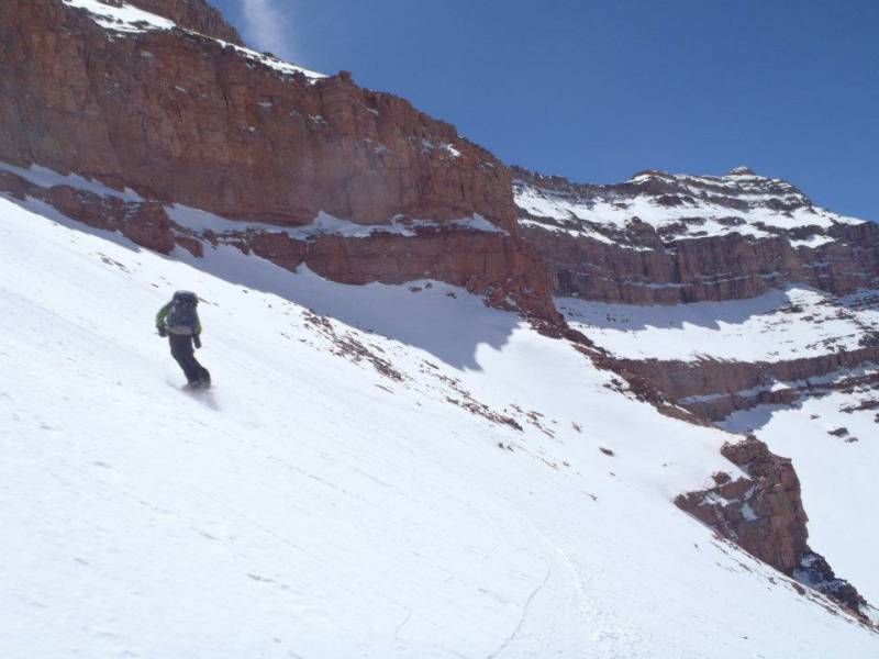
photo-Sam Jordan skiing the northeast face. photo by Zach Taylor, 2012.
photo- Zach Taylor riding Kings peak. photo by Sam Jordan, 2012.
photo- Sam Jordan skiing Kings. photo by Zach Taylor, 2012.
We skied down to the talus that separated the northeast face of Kings from the north chute that accesses Henry's Fork Basin, briefly hiked across the talus, and then enjoyed some more great turns back into the basin.
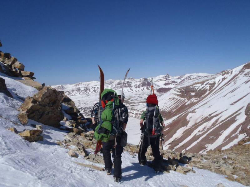
photo-Joel Paula (left) and Zach Taylor (right) hiking towards the north chute drop in with the northeast face of Kings pictured in the background. photo by Sam Jordan, 2012.
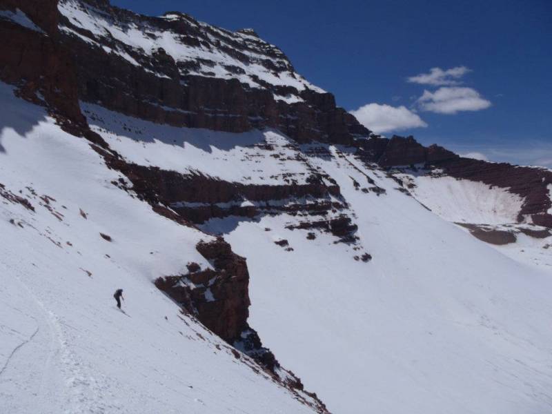
photo- Joel Paula skiing the north chute down into Henry's Fork basin. photo by Zach Taylor, 2012.
photo- Zach Taylor riding the north chute. photo by Sam Jordan, 2012.
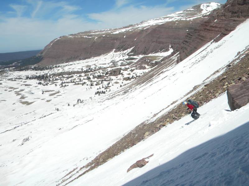
photo- Joel Paula skiing down into Henry's Fork basin. photo by Sam Jordan, 2012.
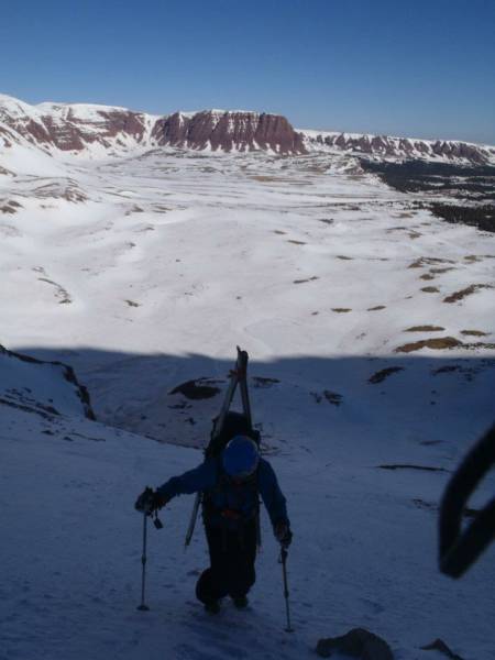
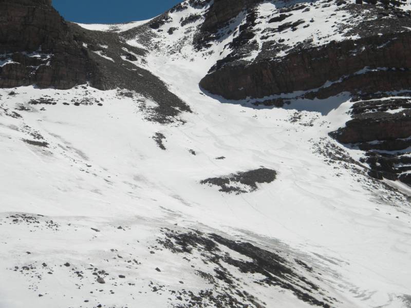
photo- Our tracks coming out of the northcirque. photo by Zach Taylor, 2012.
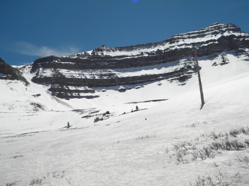
photo- Henry's Fork Basin. photo by Zach Taylor, 2012.
We rode down to where it flattened out. The pitch angle was flat enough that we ended up throwing on skins and skinning for a bit until we ran out of snow. Then we shouldered ski gear and began the long hike back to camp. The last bit before we arrived back at camp was a bit of a beat down as we had covered between 16 and 18 miles that day.
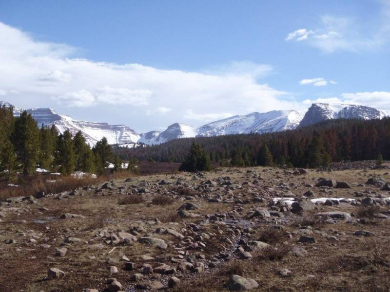
photo- Uintah beauty. photo by Sam Jordan, 2012.
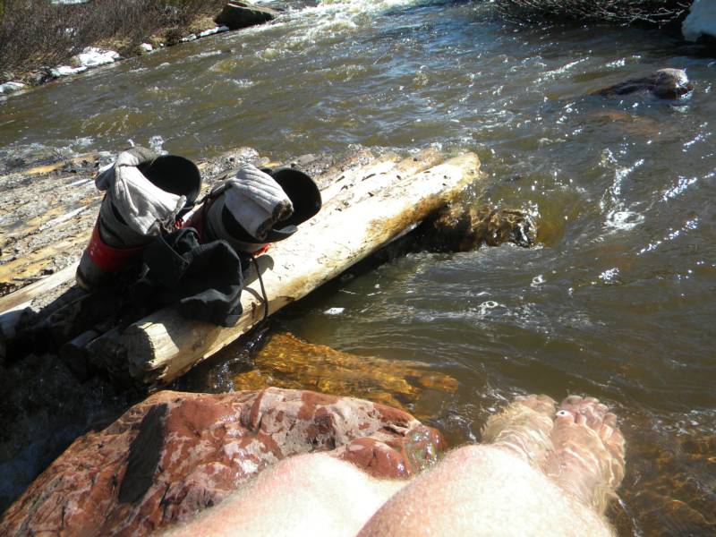
Sam and I took a few minutes just before returning to camp to dip our sore feet in the river. It felt great!
photo- Sore feet. photo by Zach Taylor, 2012.
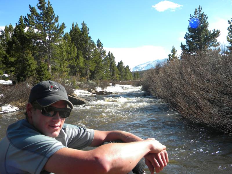
photo- Sam Jordan enjoying some cold river water. photo by Zach Taylor, 2012.
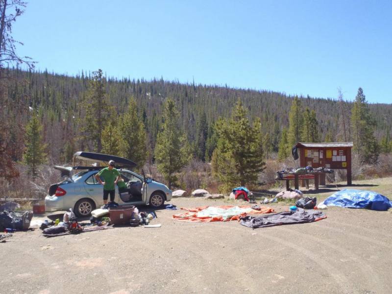
We went back to camp, drank a beer, made some mountain houses, and went to bed before the sun even set. After a good nights sleep we got up, broke down camp, and hiked out to the car.
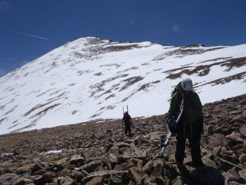
photo- Yardsale at the trailhead. photo by Sam Jordan, 2012.