members of trip: Ricardo Moreno Contro, Nick Kelley, Erik(Rik) Weiss, and Zach Taylor
ascent route: southwest slopes
descent route: southwest slopes
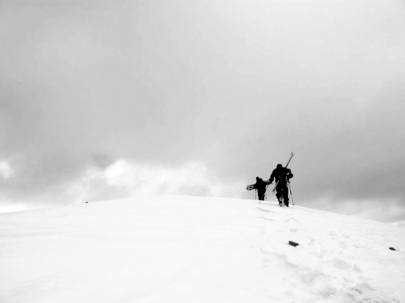
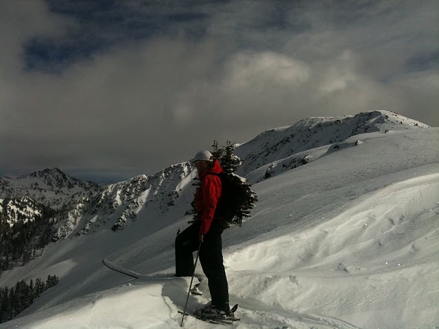
photo-Zach Taylor (left) and Erik Weiss (right) near the summit of Bald Mountain. photo by Ricardo Moreno Contro, 2011.
It is mid winter in the Colorado Rockies and I had been working a lot, riding a bit, and not summiting anywhere near the amount of peaks I would like to have been. I was restless. This time of year is hard because the avalanche danger is nasty most days and the weather is not often very conducive to getting up high.
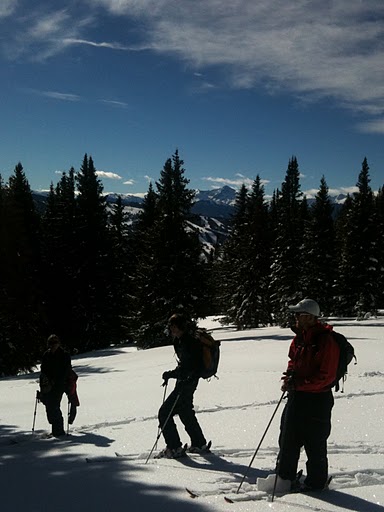
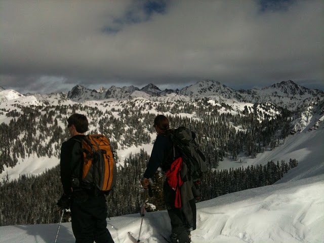
photo- from left to right Ricardo Moreno Contro, Zach Taylor, and Nick Kelley skinning above Spradle Creek. photo by Erik Weiss, 2011
A ridge of high pressure had come into the state for a couple days bringing warmish weather and clear skies. A storm seemed on track to start rolling in the next day but the 8th looked mostly clear. I made a couple phone calls and gathered a group for an ascent.
Bald Mountain is a peak that sits on the edge of the Gore range almost directly across from Golden Peak on Vail mountain on the opposite side of the interstate from the ski area. I had looked at riding this mountain for a few years and today was the day.
The ascent is about five miles one way with approximately 3,800' of elevation gain. The Colorado Avalanche Information Center rated avalanche danger in the vail-summit county zone on January 8th to be Level 1 (low) below treeline on all aspects and level 2 (moderate) at and above treeline on all aspects.
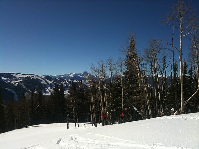
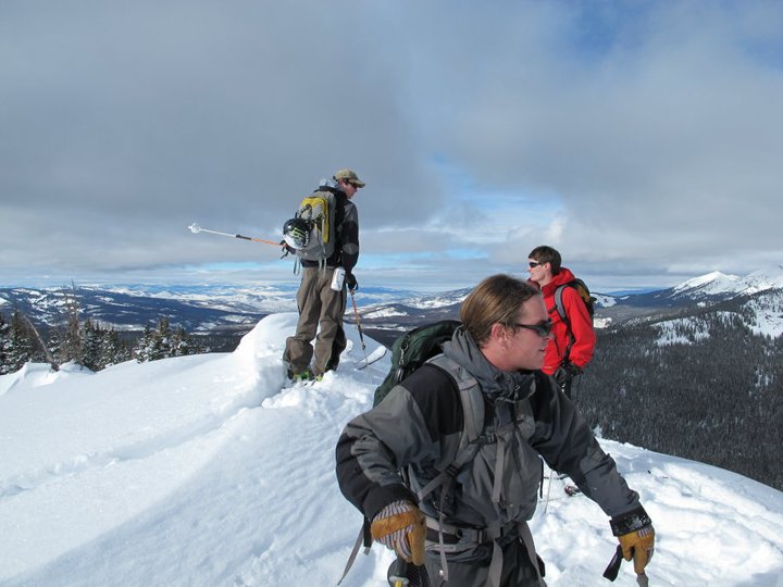
photo-from left to right Zach Taylor, Nick Kelley, and Ricardo Moreno Contro skinning up Bald Mountain. photo by Erik Weiss, 2011
Our group met up in the early morning hours, drove to the main Vail roundabout and up to the winter trail closure for Spraddle Creek at the stables. We geared up and were skinning up Spraddle Creek road an hour or two after sunrise. We quickly covered ground up the heavily used road. The road winds up the bottom of the drainage on the east side. We knew we had to cross to the drainage's west side and climb up the climbers left hillside of the drainage to gain the southwest ridge and our route to the summit so we began looking for a good place.
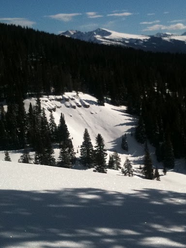
photo-a view of a cliffy area in Spraddle Creek from the southwest ridge of Bald Mountain. photo by Erik Weiss, 2011.
We saw a couple tracks descending off the southwest ridge near a good crossing point for the drainage. We crossed and began kicking in a skin track up a steep east facing slope beneath the southwest ridge of Bald Mountain. A firm sun crust that was just beginning to thaw with the early morning sun made for a slick, interesting time getting onto the ridge.
After a bit of work we were back on soft snow on the southwest ridge. The southwest ridge of Bald is broad, gentle, and very snow covered this time of year. It is not the windscoured ridge you would expect on a higher mountain during the winter.
We continued our skin heading north and slightly east towards Bald's summit (which was still out of view for quite a while). Eventually we picked up another skin track that we followed most of the way. Looking down it seemed that this track had cut up to the ridge from higher in the drainage than where we had gained the ridge. I think this route was better. If I do this tour again I will skin up the drainage road for as long as possible before cutting up to gain the ridge. As we neared treeline we began to get views of Bald's summit through the trees.
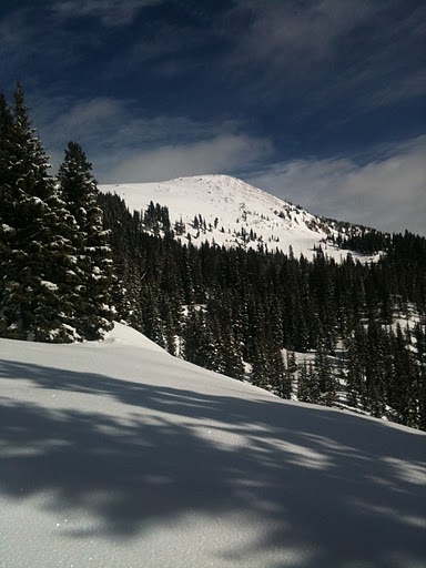
photo- A look at Bald Mountain from the southwest ridge. photo by Erik Weiss, 2011
The south face of Bald Mountain is fairly steep and looked pillowed and avalanche prone from our vantage. The southwest ridge runs into Bald Mountain's summit ridge to the west of the summit, right at treeline, and then follows the summit ridge east to the summit skirting above the dangerous south face. We were greeted with awesome snow covered views of the Gore range as soon as we gained the summit ridge. We turned right and skinned east towards the summit surrounded by views of the Gore to the north and the Sawatch/York range to the south and west.
There was one steep section of ridge near the summit that was exposed enough for us to take off our gear and climb up the snowbank. We were able to ride down this no problem on the descent. We skinned/hiked over several false summits and finally reached the high point.
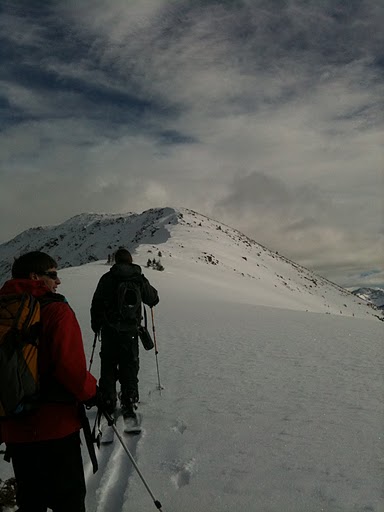
photo-Nick Kelley (left) and Zach Taylor (right) looking out over the Gore range from where the southwest ridge meets the western side of Bald's summit ridge at treeline. photo by Erik Weiss.
photo- Ricardo Contro looking out over the Gore with Bald Mountain's summit ridge pictured in the background. photo by Erik Weiss, 2011
photo- Nick Kelley (left) and Zach Taylor (right) skinning up the summit ridge of Bald Mountain. photo by Erik Weiss, 2011.
We hung out on the summit for a bit taking in the views and slowly geared up for our descent. I dropped in first riding back down the summit ridge directly west. I unstrapped my backfoot to get over the first false summit by skating and then was able to ride the rest of the way back to the car with no real flat problem spots. The snow was a combination of windscoured snow and powder till we got back to treeline and the southwest ridge.
From here on it was mostly powder with some crusts on solar aspects in open fields on the lower mountain. We enjoyed some quality powder turns on the ridge through the trees and then we dropped down into Spraddle Creek fairly quickly and much higher in the drainage than where we had gained the ridge on the ascent.
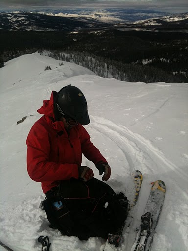
photo- Pollo getting ready to ski on the summit of Bald Mountain. photo by Erik Weiss, 2011
photo- from left to right Erik Weiss, Zach Taylor, Nick Kelley standing on Bald Mountain's summit.
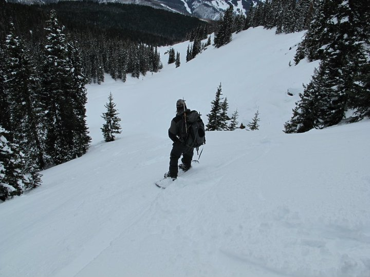
photo- Zach Taylor descending into Spraddle Creek. photo by Ricardo Moreno Contro, 2011
We rode through the bottom of the drainage. Most of this route is completely avalanche free. As we descended the drainage narrowed into a nasty terrain trap for about a hundred feet. Several other tracks cut high but from where we came down it would have been difficult to get back above the gully. With avalanche danger rated at level 1 on this aspect, no recent observed avalanche activity, cracking, collapsing or whumping we just rode through staying on the less exposed left side and spreading out. This area can be completely avoided with a little effort, and the entire route, with a little variation, can be skied without crossing any avalanche terrain if you have your avalanche eyeballs peeled and solid navigation skills. Be warned though this gully could be deadly under other conditions and is something most people skiing off Bald in this drainage will have to cross. Pay attention here and skin around it if neccessary!
We eventually hit the road and easily rode the road back out to our car. This was quite a nice tour and snowboard descent for mid-winter. I will probably do it again at some point.