members of group: Craig Burger, Zach Taylor, and dogs Kussum Kanguru and Kya
12,645' Mt Mellenthin
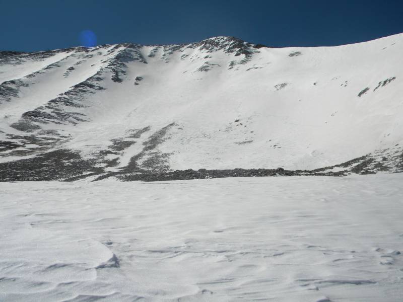
photo- A look at the north face of Mt. Mellenthin. photo by Zach Taylor, 2012
After going to Utah last weekend to ride I thought I would stay in Colorado for the weekend and try to ride a couple lines in the area but............ the weather had other plans for me. I looked around the forecasts for friday and saturday. 50-60 mph winds were forecasted for the Front range and northern Sawatch. I began rethinking things a bit and started looking at forecasts in the Tetons, La Sals, and Wasatch. The La Sals looked the best with a breezy day on friday but sun and highs in the 40s for saturday. I called up Craig, we talked a bit about options and decided to give the north face of Mt. Mellenthin in the La Sals a go.
The La Sals are a small mountain range just southeast of Moab, Utah. It is a linear range that runs north to south. It can be divided into three sub groups of peaks. The northern, middle, and southern groups. The middle group is the largest and contains the three highest peaks in the range; Mt Peale (12,721'), Mt Mellenthin (12,645'), and Mt. Tukuhnikivatz (12,482'). Mt Peale did not have a good snow line off it this year because of low snow and wind. I had gotten a great descent off Tuk the weekend before, and after making a few phone calls and looking at some maps I figured Mellenthin's north face would probably be in as well.
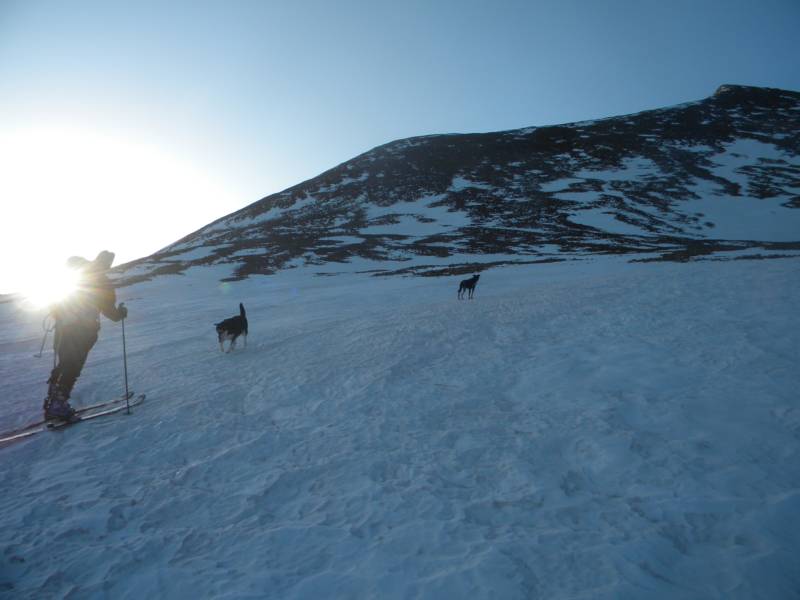
I got up on the morning of the 6th and drove to Glendwood to meet up with Craig and his dogs for a trip to Moab. I dropped my car at his house, loaded into his Subaru, and started driving west. We called his friend Ann, who had skied the north face of Mellenthin before, and got some info on the line.We got to Moab and to the trailhead by early afternoon. It was breezy and sunny on the skin in. We started at the Geyser pass winter road closure and skinned partway up Geyser pass road before hanging a right (south) and skinning up a field towards the northwest ridge. We pitched camp with a beautiful view of Moab below and enjoyed the sunset and some tequilla!
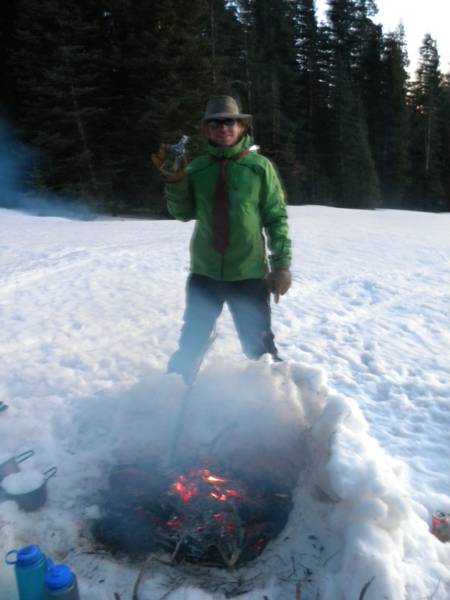
photo- Craig Burger enjoying some tequilla at basecamp. photo by Zach Taylor, 2012
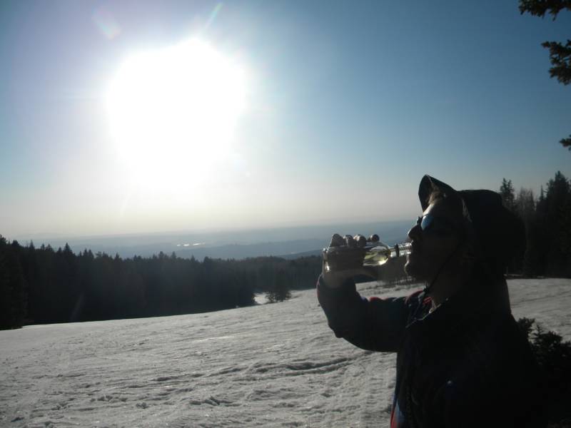
photo- Zach Taylor enjoying some tequilla. photo by Craig Burger, 2012.
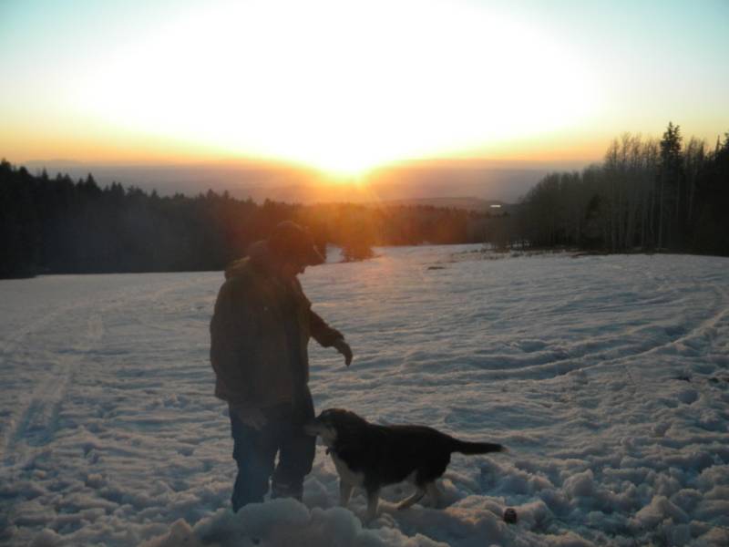
photo-Craig and Kya. photo by Zach Taylor, 2012
photo-Craig and company skinning towards the northwest ridge of Mellenthin. photo by Zach Taylor, 2012.
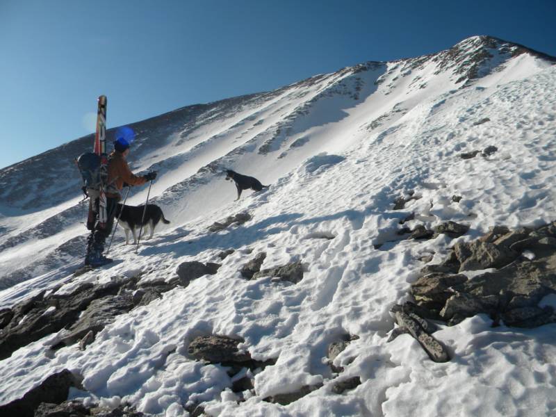
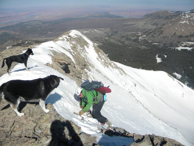
The alarm went off at 5am and we got a leisurely 6:30 am start. It was only 5 or 6 miles and about 2500' elevation gain from our camp to the summit and back. We skinned up to treeline and then shouldered skis and began hiking up the northwest ridge. It was a steepish, talus filled ridge with plenty of loose rock. We snow climbed a bit but spent most of our time on rock on the ridge.
photo-Craig Burger on the northwest ridge of Mt. Mellenthin with it's north face pictured behind. photo by Zach Taylor, 2012.
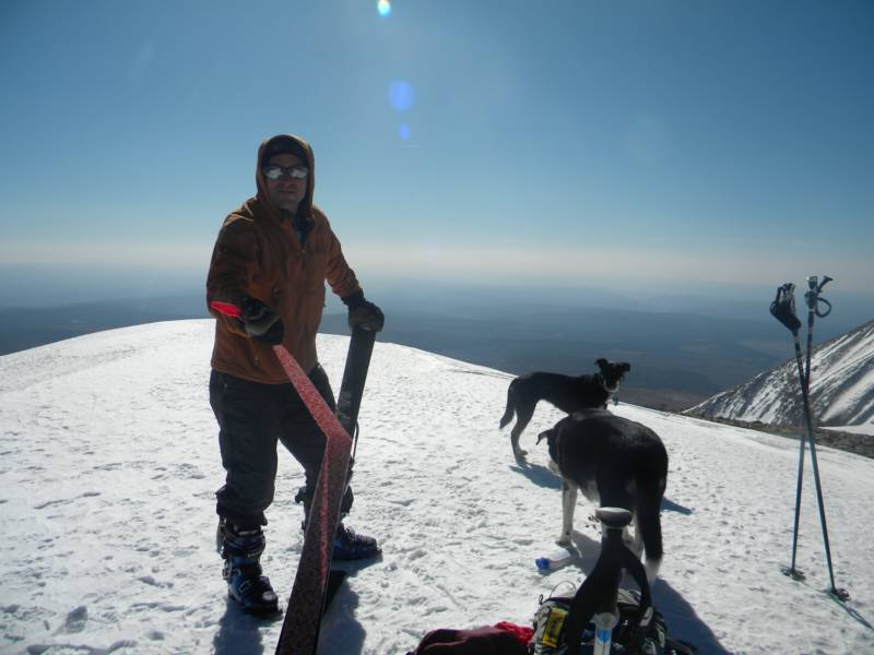
photo- Craig Burger near the summit. photo by Zach Taylor, 2012.
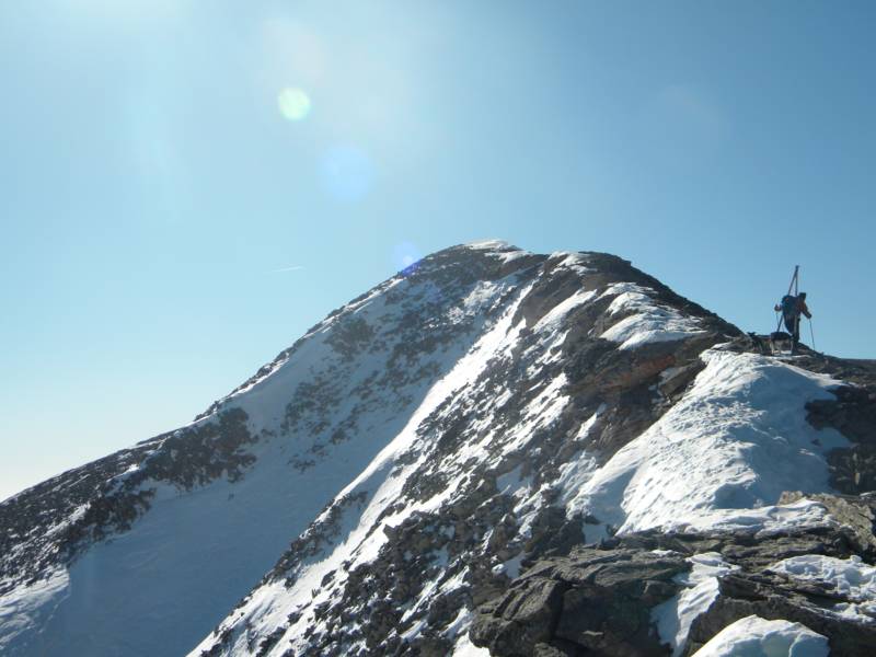
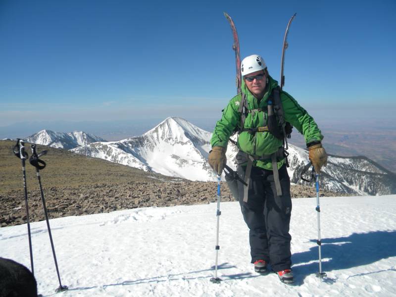
After a couple more hours of ridge hiking/scrambling we made our way onto the summit. The views were as good from Mellenthin as they were from Tuk last week.
photo-Zach Taylor on the summit with the north face of Tukuhnikivatz pictured behind. photo by Craig Burger, 2012.
photo-Craig Burger on the summit of Mellenthin. photo by Zach Taylor, 2012.
Despite beeing sunny, it still seemed a bit chilly on the summit. We ate some bacon, crackers, and cheese and began to try to figure a way down off the ridge onto the face. You cannot ski from the summit directly at this point, this year, but you can from a couple hundred feet down the summit ridge. We walked down looking for a good strip of snow to get into the north face on. At first I tried a little cliff downclimb;
photo- Zach Taylor trying to downclimb into the north face of Mellenthin.
Downclimbing here ended up beeing harder than I thought. Lots of loose rock below 8-12" of loose snow. I climbed back up and we walked another 75' or so and found another way down onto the north face:
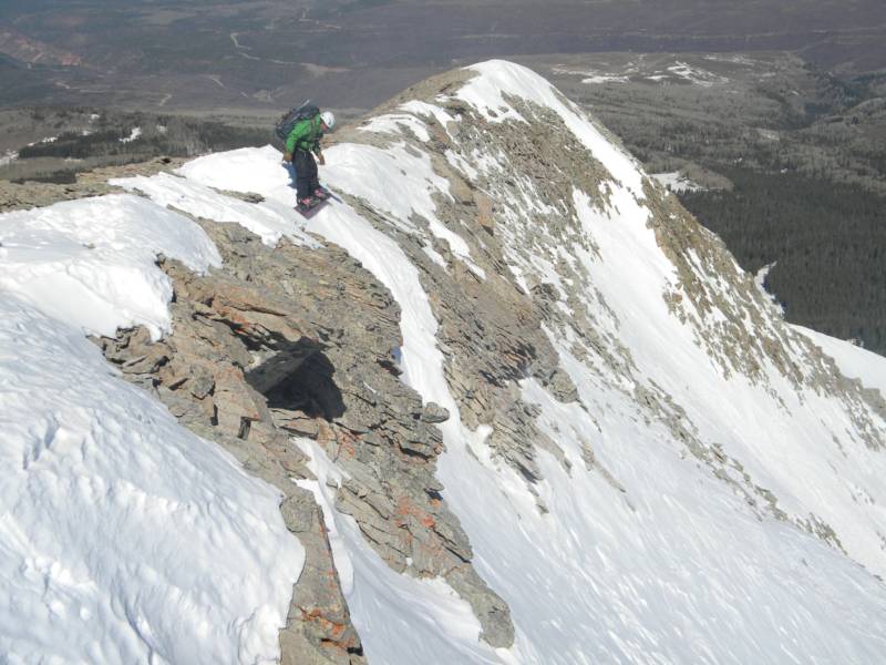
photo-Zach Taylor getting ready to ride the steep ramp onto the north face. photo by Craig Burger, 2012.
This little strip of snow looked impossible from the summit but once I was standing above it I realized that it was not as steep or as long as it looked. It was still steep. exposed above a couple cliffs, and interesting to say the least. I took a few minutes from above to think about how I was going to make this work.
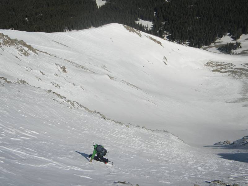
I pointed my board downhill and angled slightly rider's right through the ledge and onto the north face and slammed on an edge once I rode off the ledge onto the north face. I took a couple fun jumps turns through the soft, pushy snow.
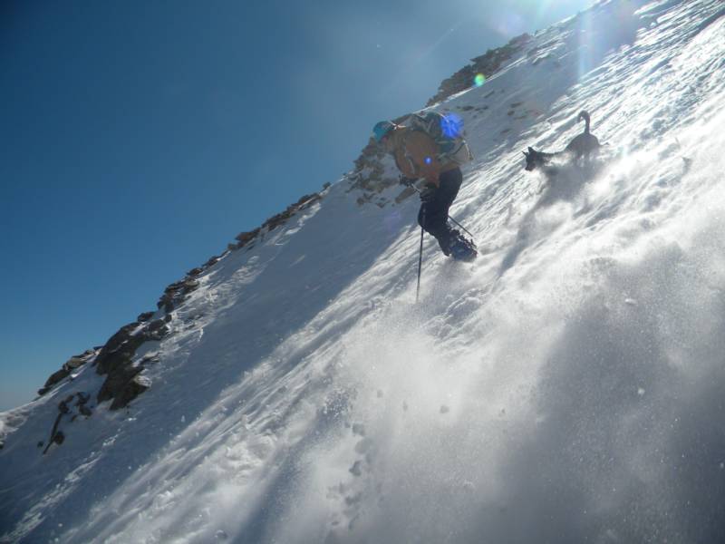
photo-Zach Taylor riding the north face of Mt. Mellenthin. photo by Craig Burger, 2012.
I stopped about 500' below the entrance to wait for Craig to get onto the face. He fiddled a bit with his bindings and spent a few minutes on top figuring out his line. Then he too dropped onto the ledge and made it onto the face safely. The dogs followed with no problems. We took turns riding down the face.
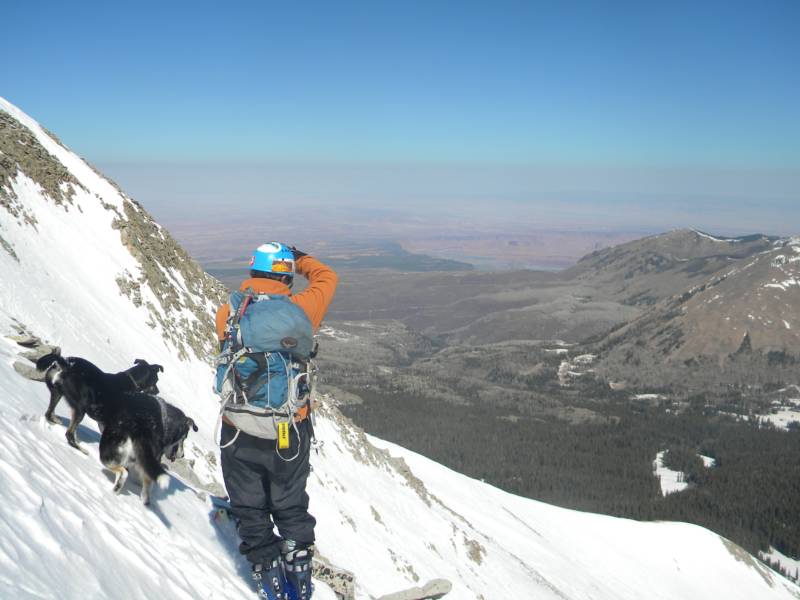
photo-Craig and dogs looking out at the desert. photo by Zach Taylor, 2012.
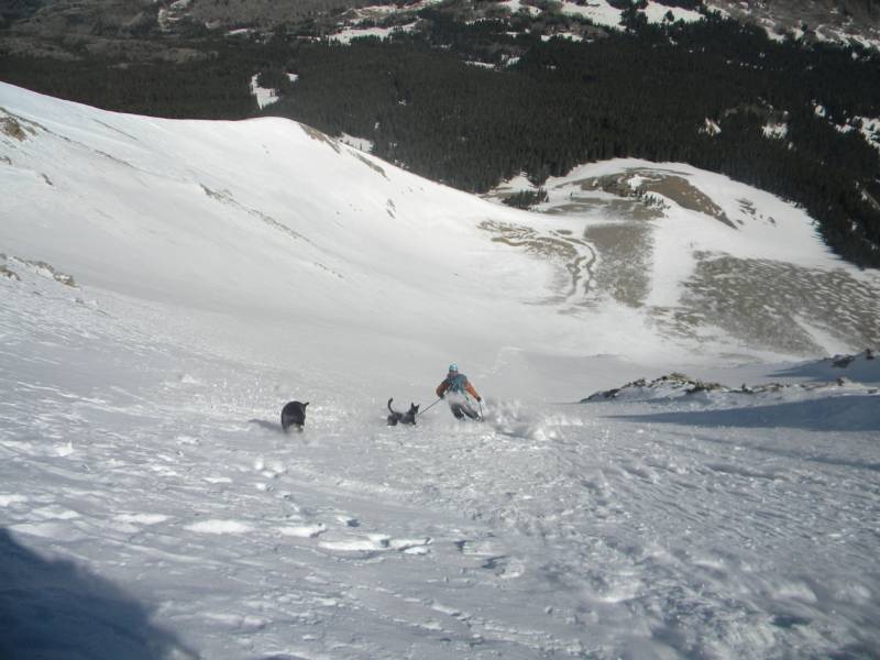
photo-Craig skiing the north face. photo by Zach Taylor, 2012.
photo-Craig skiing Mellenthin. photo by Zach Taylor, 2012.
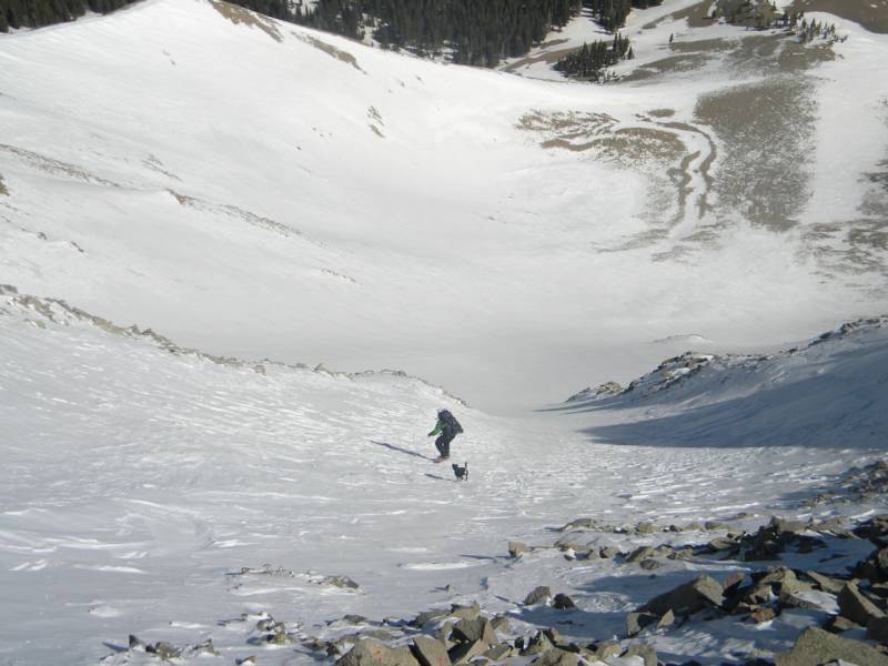
photo-Zach Taylor riding Mt Mellenthin. photo by Craig Burger, 2012.
The ramp was probably a bit over 50 degrees in pitch and too narrow to turn through. It was not as hard as it sounds or looked to us though. A couple seconds of pointing our planks and we were onto much mellower terrain. I would guess the north face pitched out somewhere in the low 40s at most. The top 400-500' was soft, pushy powder, then hardpack, then some sun softened (not quite corn snow at the bottom). It was a nice line with good accessibility and we were able to skin from the parking lot and ride all the way back.