ascent/descent route: Geyser pass winter closure to Gold Basin. ascent of east chute to east ridge. descent of south face to east chute.
12,482' Mt. Tukuhnikivatz
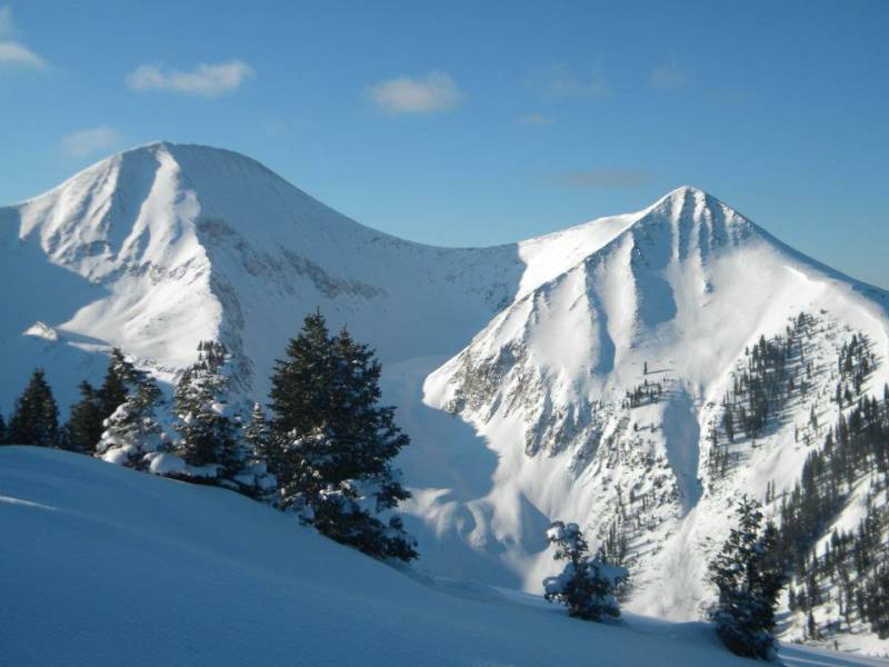
photo-A look at the north faces of Mt. Tukuhnikivatz (looker's left and Tuk No (looker's right). photo by Zach Taylor. 2012
It was the best of times. It was the worst of times. Colorado has had the worst season since at least 01-02. In reality, I am not sure there is a season in the central Rockies that has been this bad in over 30 years. It is the end of March and most of the mountains look like it is the end of May...or later.
Last weekend my roommate and I attempted the south face of Mt. Oxford via Pine Creek. We spent hours wallowing/"skinning" (using the term loosely here because I view the term skinning in a pleasant context generally, there was not much pleasant about this experience except the view) in knee deep slush, bushwacking, taking our touring gear on and off to walk over extended dry areas and climb over/through down timber only to get turned around the next day due to unstable, avalanche prone snow conditions at 11,000'.
I had finally turned in all my nursing school applications and most of my scholarship materials, work was quieting down for the season, and I had another weekend off. I wanted to climb a mountain and do some riding. The prospects in Colorado were dismal. Most of the lines I though about were either too melted out, had extremely long, half dry approaches, or probably still had an avalanche risk associated with them that I was not comfortable with yet.
I had spent some time in the La Sal mountain range outside Utah earlier in the winter and had a great time. I pulled up the avalanche report for the area and saw that the UAIC rated ave danger low on the northern side of the compass. I had had my eye on a mountain, Mt. Tukuhnikivatz, since I had first seen it in Chris Davenport's, "50 Classic Ski Descent of North America," book last year. After laying my eyes on it earlier this winter and seeing the ave report, I began to think a little.
A friend if mine, Max, is the forecaster for the La Sal Mountain range UAIC. I gave him a call and got some info. Max informed me that you could still skin from the trailhead, that the north facing lines were snow covered and probably avalanche safe depending on the time of day, and that I should come and enjoy the corn harvest before the La Sals ended up looking like the Sawatch.
photo- Sunrise over the La Sal mountains. photo by Zach Taylor, 2012.
I had talked to Joel earlier in the week and he said that he wanted to ski a peak this weekend but was flexible about what. I had said that I would do a little research and get back to him. I made a quick phone call and Joel said that he was down.
We made plans to leave at 6:30 am on friday (March 31st) to drive to Moab, skin in, and do a recon of the area, before a summit attempt on Saturday. We left, close to on time, at about 7am. We got into Moab by late morning. It was extrememly busy in town with 4 wheelers. mountain bikers, and the sight seeing tourist crowd filling the city. Spring and fall are great weatherwise to vist Moab but they always seem to be extremely busy. We stopped at the grocery store to get some food and swung into Max's office to get some last minute route info.
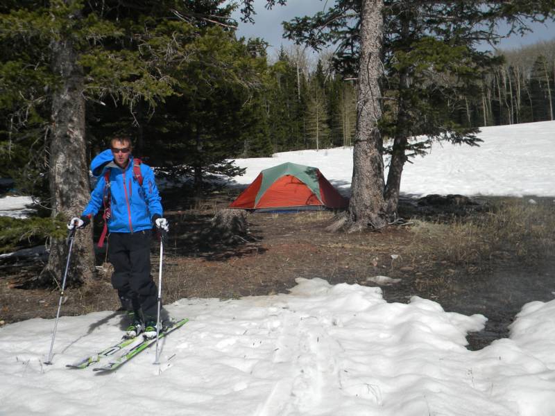
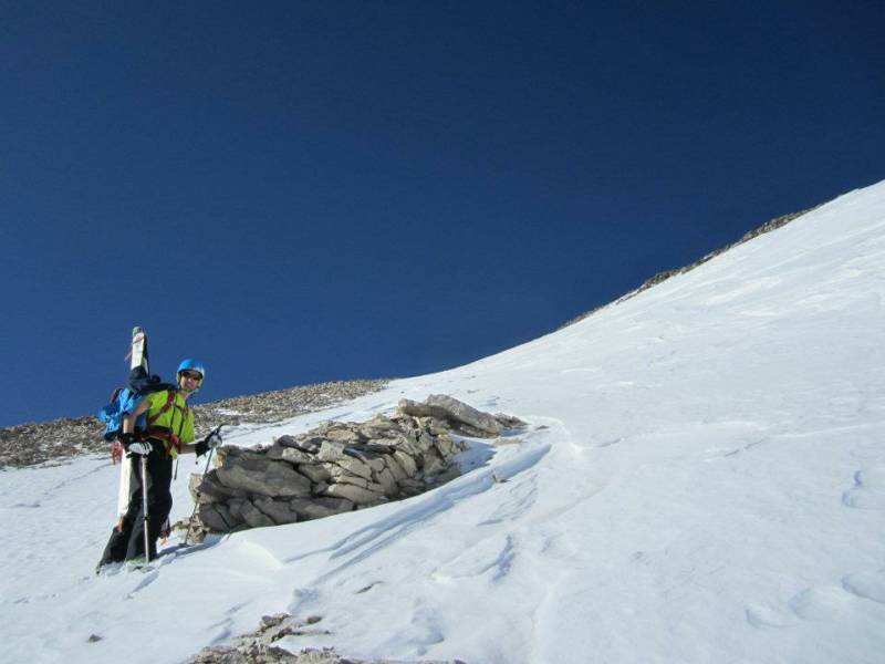
We got in and out of town pretty quickly and were driving south of town, winding up Geyser pass road pretty quickly. The desert dropped off below us as we entered forest and snow. We got to the Geyser pass winter closure geared up and skinned in about a mile to a saddle around 10,200' that showed beautiful views of the desert below and the high peaks of Gold Basin above. Joel and I found a nice ground patch to camp on, made dinner, and enjoyed views to the west of the sun setting over the Utah desert below.
photo- Joel Paula hanging out at camp in the La Sals. photo by Zach Taylor, 2012.
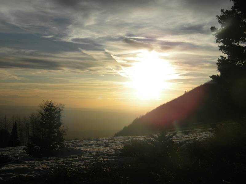
photo- Sunset over the desert from 10,000'. photo by Zach Taylor, 2012.
The alarm went off at 4am. I brewed some mate ate a little breakfast and we were skinning by 5am. We skied slightly downhill on FS 141 below the popular northwoods backcountry ski area and to the weather station where we hung a left with some old ski tracks onto a closed road that is more of a trail now. This trail is the key to easy access of Gold Basin and its high peaks. Having snowboarded out of this trail earlier in the winter and having scouted the turn off again the previous afternoon it was easy to find in the dark. If you are unfamiliar with the area finding this little turn could be problematic in the dark. I would recommend finding this turn off the day before trying to get into this basin in the early morning dark.
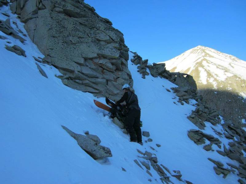
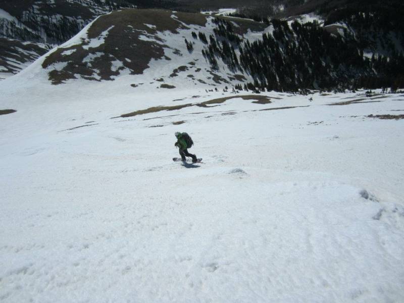
We made quick time up the open, frozen skin trail into the basin. We skinned below the north face of Tuk No just as light began to filter down making headlamps unnecessary. We took a right and began to climb steeply up below the north face of Tuk. The north face of Tuk is bisected by a spine that faces almost directly north. This spine divides the north face into a northeast and a northwest face and supplies a loose but often climbed way of accessing Tukuhnikivatz. We aimed for the spine and began a scamble up loose, snow covered rock.
photo- Zach Taylor on the north ridge of Mt. Tukuhnikivatz. photo by Joel Paula, 2012.
photo- Zach Taylor scrambling on loose rock of the north face of Tuk. photo by Joel Paula, 2012.
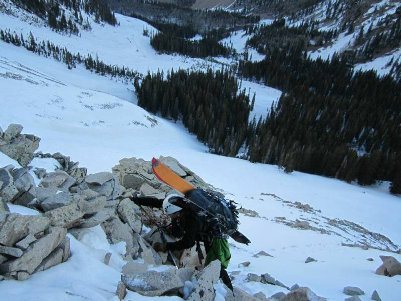
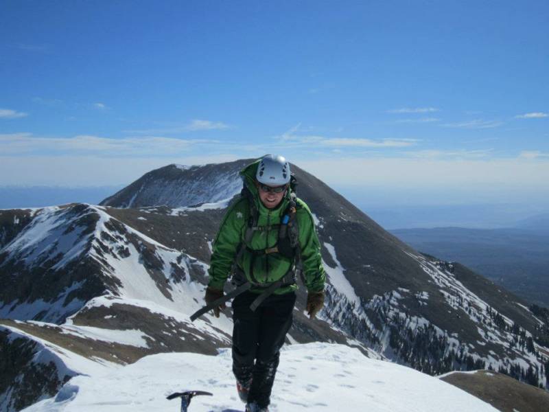
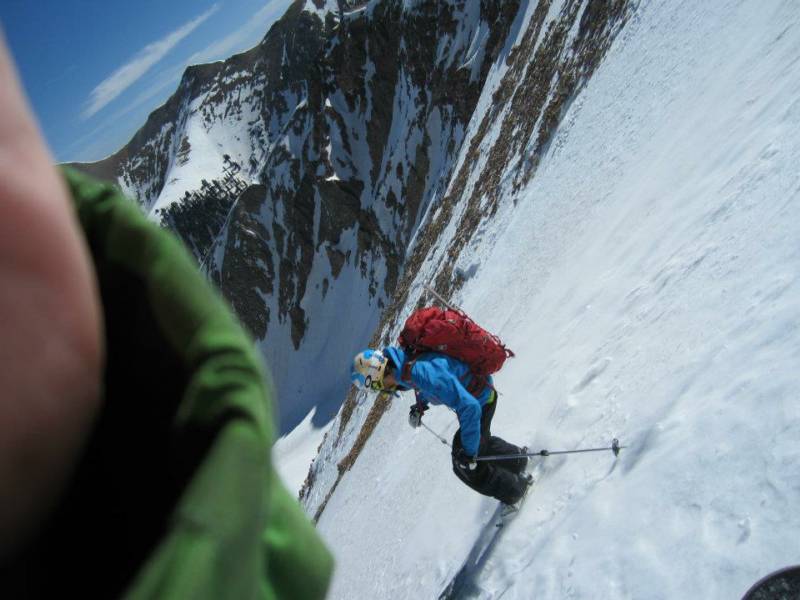
We arrived at Pt 11,359' after some less than pleasant, exposed scrambling. We got a good view of the upper mountain and decided to leave the ridge for a better ascent route on the upper mountain. We hiked along a flat area below the northeast face and climbed up a north facing chute that paralled the northeast face to its east. We enjoyed some snow climbing up to the summit ridge.
photo- Zach Taylor climbing the north side of Tuk. photo by Joel Paula, 2012.
photo- Joel Paula near the summit ridge of Tukuhnikivatz. photo by Zach Taylor, 2012.
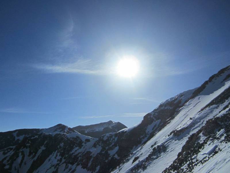
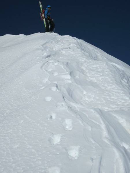
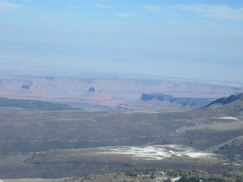
We hit the snow caked, east summit ridge about 400' vertical feet below the summit. The panorama of the surrounding area was spectacular. We could see Canyonlands, Castleton Tower and all the desert below us while also looking at the other surrounding La Sal high peaks. There is no where else I know where you can enjoy high peaks like this while also beeing surrounded by high desert like this. It was quite the view. We climbed on snow all the way to the summit.
It was a bit breezy on the summit but we enjoyed the views and sunshine for a few minutes before our descent.
photo- Joel Paula on the summit ridge. photo by Zach Taylor, 2012.
photo- Views of the desert from the summit of Tuk. photo by Zach Taylor, 2012.
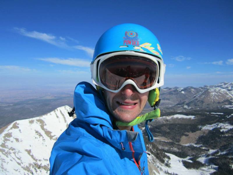
photo- Zach Taylor on the summit of Tuk. photo by Joel Paula, 2012.
photo- Joel Paula on the summit of Tukuhnikivatz. photo by Zach Taylor, 2012.
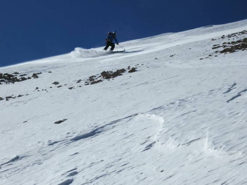
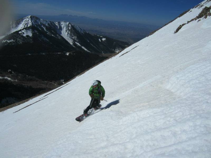
The entrance into the northeast face was melted out and rock studded. Getting down into it would have been interesting, bordering on sketchy, so we decided to drop down the south face and contour east so we could hit the saddle between Tuk and Pt 11,890' to the east. From there there was a cool looking, north facing chute we could descend back into Gold Basin. Action shots!:
photo- Zach Taylor on the south face of Tuk. photo by Joel Paula, 2012.
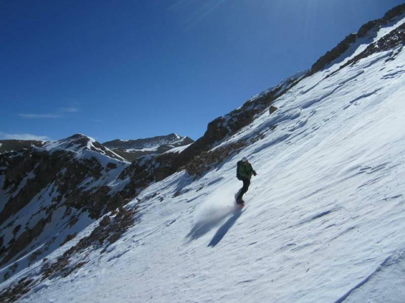
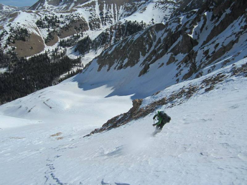
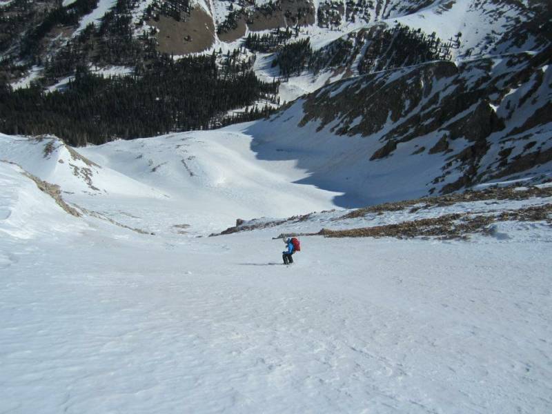
We contoured back to the saddle and dropped into the north facing chute back into Gold Basin:
photo- Joel Paula skiing Tuk. photo by Zach Taylor, 2012
photo- Zach Taylor on the north face of Tuk. photo by Joel Paula, 2012.
photo- Joel Paula on Tuk. photo by Zach Taylor, 2012.
photo- Zach Taylor on Tuk. photo by Joel Paula, 2012.
photo- Joel Paula skiing Tuk. photo by Zach Taylor, 2012.
photo- Zach Taylor riding Tuk. photo by Joel Paula, 2012.
The descent's average pitch was probably in the low to mid 40s and we skied above some cliffs coming off the summit. With the day's winds keeping the snow surface hard and frozen our turns were a little exposed in the upper sections of this descent. With good corn snow the descent would have been perfect. It was definitely a classic and a great day out though. We were able to skin from the trailhead, ride directly off the summit and ride all the way back to the trailhead. The avalanche danger was legitamately low on this day as well. This combination of factors is almost unheard of in Colorado this year. We thoroughly enjoyed it. We rode out of Gold Basin, skinned back up to camp, broke camp, and made our way back to Colorado.
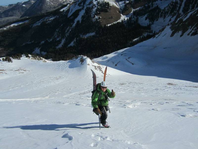
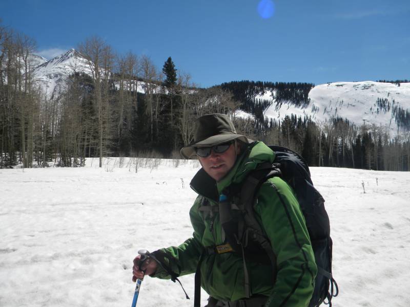
photo- Zach Taylor enjoying the La Sal sunshine. photo by Joel Paula, 2012.