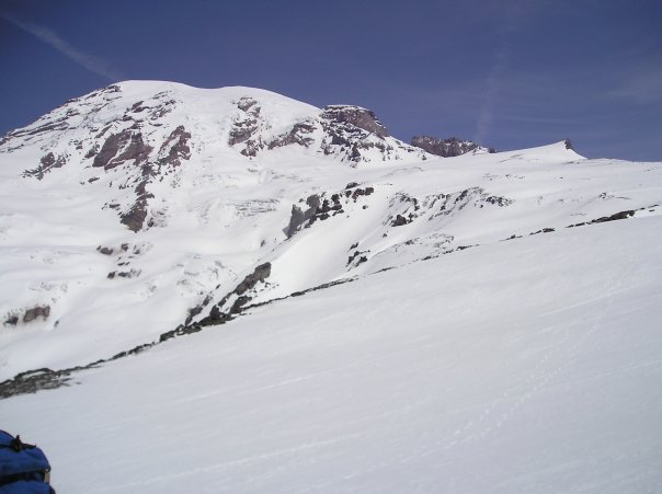
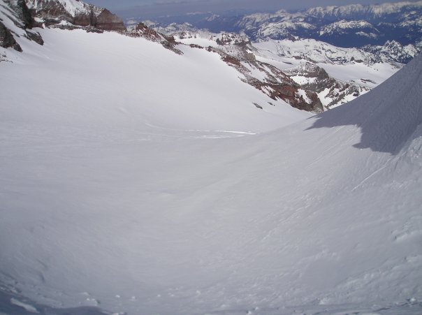
photo-A view of Mt. Rainier from the south. The Nisqually Glacier is the primary snow line coming down the face.
Mt. Rainier 14,410'
Members of trip: Mike Bannister, Ricardo Contro(Pollo), and Zach Taylor
Ascent/descent route: Muir Snowfield to Ingraham Glacier.
Trailhead: Paradise 5,420'
I had been thinking about climbing Mt. Rainier since I was 18, going to school at CU-Boulder, and just getting into climbing. Rainier is one of the largest mountains in the continental United States. It takes 10,000 vertical feet of climbing to summit. The average Colorado 14er is only a wimpy 4,000 vertical feet by comparison. Rainier dwarfs everything around it. It is covered with large, snow capped glaciers with large crevasses, icefalls, and vertical relief similar to the other great mountains of Alaska, the Andes, and the Himalayas. It just lacks the altitude. This mountain has been the training ground for generations of American climbers before they departed for the higher mountain ranges of the world. A trip to Denali, or even Everest is usually preceded by a climb on Rainier.
I had been talking to Mike and Pollo about this climb since late fall/early winter of the year prior. We made our plans 4/30/09-5/7/09. We would take a road trip through Utah, Oregon, and Washington to hopefully climb and ride Rainier as well as whatever else we wanted to ride along the way.
We arrived in Rainier National Park on 5/1/2009. We stayed in a hotel room right off the road that enters the park from the south. It got dark about 9:30 pm. We sorted gear and discussed the climb.
We got up early on 5/2 to drive into the park and up to our trailhead at Paradise at 5,400'. The mountain rose 10,000 vertical feet up just a couple miles to the north.
It was a beautiful, sunny day. We unloaded all our gear, filled out our climbing permits, and did last minute beacon checks.
The Paradise trailhead sits just to the southeast of Mt. Rainier. We began skinning up a well established skin track to the north. There was a lot of people out on the lower mountain that day. The weather was warm and sunny and the winds were mild. We skinned up a low angled flank/ridge that would eventually climb up to McClure rock which marked the beginning of the Muir snowfield.
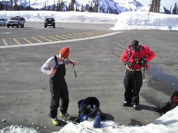
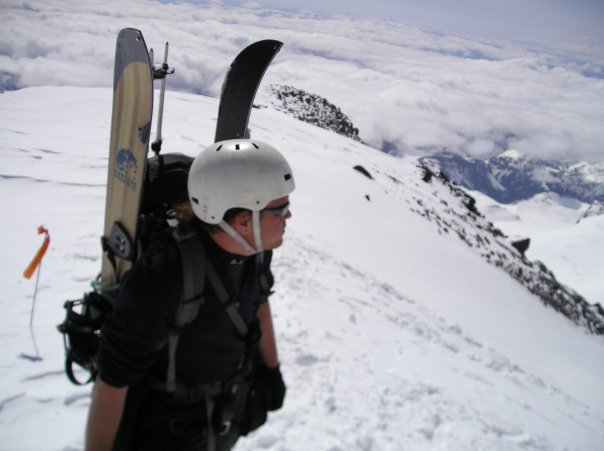
photo-Mike Bannister and Ricardo Contro gearing up in the Paradise parking lot. photo by Zach Taylor, 2009.
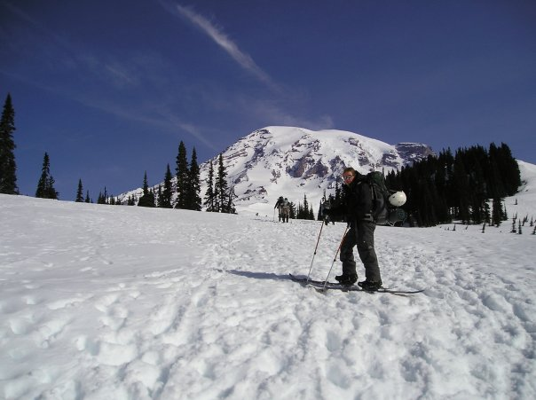
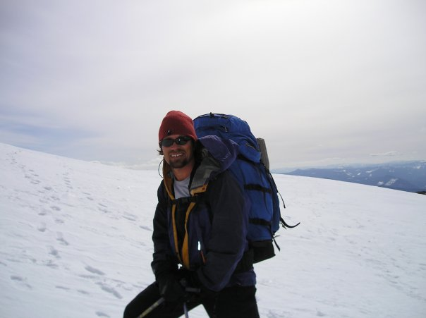
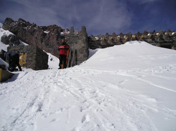
photo- Zach Taylor at the base of Mt. Rainier. photo by Ricardo Contro, 2009.
The low angled skin came to a stop as we emerged at the base of a steep headwall. Most climbers were using a mountain axe and crampons to climb up the right side of the headwall. Pollo switched over to snow climbing gear. Mike and I insisted on attempting to skin up this headwall. I had a pair of Voile skinning crampons for splitboards that I figured I could make it up with. Mike had just recently made a similar purchase for his skis. I looked around, if I slipped the runout was clean and there were no rocks or boulders at the base of the face. The snow conditions were hard pack and perfect for attempting to skin up a 45 degree pitch. We started skinning up the headwall and around the line of climbers ascending the pitch. We saw one skier above us skinning as well. He suddenly seemed to lose balance near the top and tottered over. He slid past us, trying without success to use a ski pole self arrest(these rarely work). He slid out to the bottom of the headwall and decided to use his snow climbing gear instead.
We continued skinning up. I payed close attention to each slide of by boards. I did not want to end up like this guy at the base of the pitch having to shoulder a 70 pound pack BACK up this slope. We made it up and over the headwall. McClure rock and the Muir snowfield came into view above us. This time of year everything is covered in snow so you can't really tell where the snowfield officially started. During the summer this is where snowline is. We were at about 7300'.
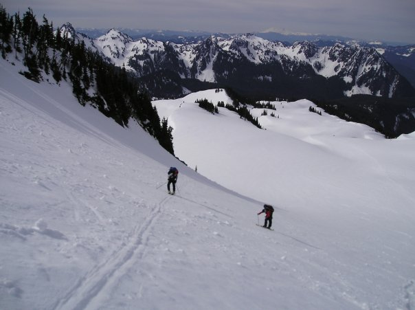
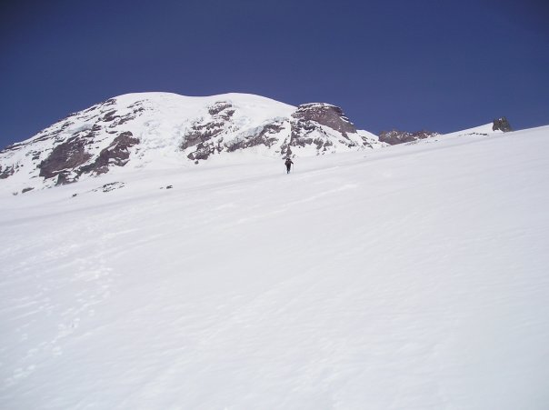
photo- Mike Bannister(left) and Ricardo Contro make their way up the Muir snowfield. The Tatoosh mountain range is pictured in background. photo by Zach Taylor, 2009
photo- Mike Bannister on the Muir snowfield. photo by Zach Taylor, 2009.
We easily skinned up to Camp Muir from here. The pitch angle was mellow the whole way up the snowfield. We eventually spotted the buildings that comprise Camp Muir poking out of the snowy distance. The mountain is so big that our distance perception was off and it still took us quite a while to get to the shelter after spotting it.
We came in to Camp Muir with quite a few people around us. We took off our packs, unrolled sleeping bags and claimed sleeping places in the public shelter(their are also several shelters for guided groups). We talked to a group of Ukranians that had just summited that day and were headed down. This crazy group of climbers had not brought any ropes and used no crevasse rescue equipment while tiptoeing across snow bridges on the Ingraham Glacier. This did not seem too smart.
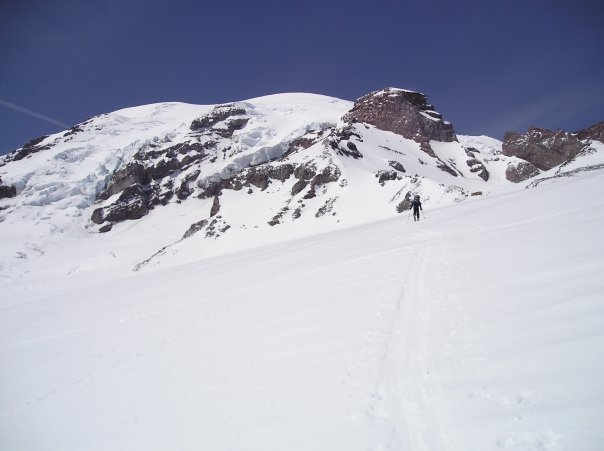
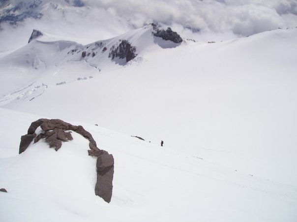
photos(above and below) A skier makes his way up the upper Muir snowfield. Camp Muir sits just beneath the large rock to lookers right of the summit of Rainier. photo by Zach Taylor, 2009.
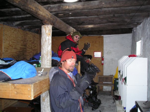
photo-Mike Bannister(foreground) and Ricardo Contro(background) hanging out in the Muir shelter at camp Muir. photo by Zach Taylor, 2009.
photo-Ricardo Contro standing out side the Muir shelter. photo by Mike Bannister, 2009.
We talked to everyone up there and one recurring theme was weather which we had also seen on the forecast. There was wave after wave of storm forecasted for the next week without alot of breaks in between.
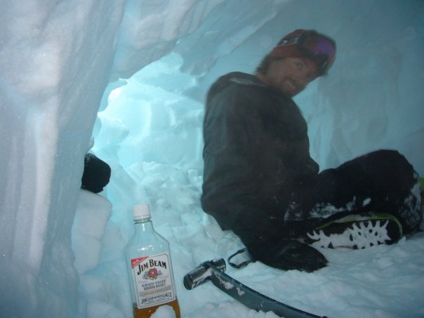
Eventually most of the people left. We went to bed early hoping the weather would hold off long enough for us to summit. It was clear skies when we went to sleep. Our alarm went off at 3:00 am. We woke up to howling winds and heavy blowing snow. We would not be attempting Rainier today. We went back to sleep. We spent the entire day of May 3rd hanging out in this storm. Visibility and wind made it such that we could not go more than a few feet from the shelter for fear of getting lost. We expanded a snow cave we found dug into a snowbank next to Camp Muir and did some beacon rescue practice. We brewed cup after cup of tea for lack of anything better to do. On occasion someone would materalize out of the clouds from Paradise and come into the shelter. They would then head back down into the whiteout. No one attempted Rainier this day.
In the afternoon a party of three climbers from Alabama appeared. They planned on attempting Rainier the next day. A couple hours later three skiers from Utah appeared with plans to also ski Rainier tommorrow. We all hung out telling climbing stories and attempting to amuse each other as much as possible. With the continued snow we began to worry about avalanche danger on the upper mountain even if weather cleared.
photo-Zach Taylor(left) and Mike Bannister(right) hanging out in the snow cave at camp Muir during the storm. photos my Ricardo Contro, 2009.
We all went to bed waiting to see what weather the next day would bring. We figured avalanche danger would be sketchy and that we would probably wait another day. We woke up at about 5:00 to clear, calm skies. We went outside to poke around and see what was up with the new snow.
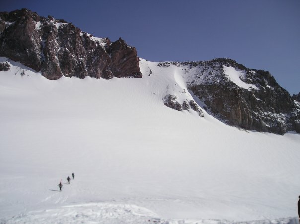
I could look across the Cowlitz Glacier and still see the bootpack climbing up the headwall to Cathedral Gap. The wind seemed to have been our friend scouring off the slope that we thought would be an avalanche problem. I did some poking around on some wind pillows above the camp. They didn't do anything on isolated slopes with me jumping around on them. We decided to give it a shot. The Utah climbers decided to as well. The Alabama climbers decided to hang out at camp. One of them had a good case of AMS and they wern't feeling it. The Utah climbing party roped up and skinned out across the upper Cowlitz glacier. We gave them a little distance, then started out ourselves. We went a little down further into the glacier than we would have liked to to avoid the ave exposure above us.
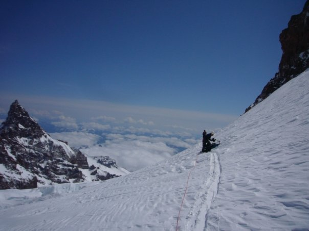
photo-A view of the upper Cowlitz glacier and Cathdral Gap from Camp Muir. Cathdral Gap is the obvious headwall above the glacier. The Utah climbers are pictured here making their way across the glacier. photo by Zach Taylor, 2009.
photo-A look down the Cowlitz Glacier from Camp Muir. photo by Ricardo Contro, 2009.
We could look down the glacier and see crevasses several hundred feet beneath us. We knew that there were crevasses underneath us at this point too. I had never been on a crevassed glacier before and this was quite intimidating. I was going to be snowboarding through here on the way back down. We skinned across the Cowlitz glacier, roped up. I kept on looking at my feet waiting to see a crevasse appear. Nothing came, the upper part of the glacier was filled in enough that we did not cross any snow bridges here. I did talk to several people over the previous two days that mentioned falling through crevasses in this area on past climbs here.
I believe this is more of a problem later in the year when the season's snow melts off and crevasses on the mountain become more pronounced.
We arrived at the base of the climb up to Cathedral Gap. We unroped and put our boards on our backs and put on the axe and crampons. Cathedral gap divides the south side and east sides of the mountain and allows passage from the upper Cowlitz Glacier to the Ingraham glacier which would be our ascent route to the top. It is a moderate snow climb of between 40 and 45 degrees pitch if I were to guess. We did not take any slope angle readings here.
We began to climb up the headwall and summited Cathedral Gap fairly quickly. From here the upper mountain and the massive Ingraham glacier came into view. Wow. Looking across the glacier I could see large crevasses both above and beneath us. You could see ice cliffs towering above and in sections of the glacier. It was an impressive view.
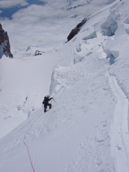
photo-Zach Taylor standing on top of Cathedral Gap. photo by Ricardo Contro, 2009.
We roped back up on top of Cathedral Gap and put away the axe and crampons. We followed the Utah climbers skin track out on to the Ingraham flats at 11,100'. The Ingraham flats is a flat area of the Ingraham Glacier that is used as an advance base camp by some climbers. It does lack the comfort of the Muir shelter.
Looking around we were quite glad that we had stayed at camp Muir during the storm instead of in a tent in this unhospitable place. The upper Ingraham glacier rose directly above us and the rockband that marks the Disappointment Cleaver rose to climbers right of us here.
photo- Zach Taylor(in front) and either Mike or Pollo on the Ingraham glacier. photo by either Mike or Pollo, 2009.
We could see the Utah climbers about a 1000' above us and their steep skin track zigzagging through the crevasses descended down to where we stood.
We discussed whether to skin up this steep glacier or get the axe and crampons. We decided to skin. We knew it would be very steep skinning but we decided to do this so that we could follow the Utah climbers skin track up the glacier. We reasoned that this would expose us to less crevasse danger.
The angle quickly steepened as we began our steep switchbacked skin up the glacier. Despite all the snow, large crevasses that disapeared into blackness surrounded us. We began to cross snow bridges across crevasses here.
Clouds had been starting to thicken around us as we had climbed up to Cathedral Gap. We started paying close attention to the weather. We did not want to negotiate this glacier in a whiteout.
The clouds continued to get darker and bigger to the North. They seemed to be forming up around the mountain. We decided to continue for a bit more and give it a few more minutes to see what was happening. The wind began to pick up a bit now too.
Clouds descended into view and we lost site of the Utah climbers above us. We stopped and discussed our options. We decided it was time to turn around. We knew it would be very sketchy if we tried to snowboard/ski through this glacier in a whiteout. It was time to descend.
I looked down at the Ingraham flats about 1500' beneath us. We had made it to about 12,600'.
We decided it would be best to slowly tandem ski down through the crevassed glacier crossing snow bridges one at a time. This turned out to be very awkward as one person would cross a snowbridge and then accidently yank on the next person.
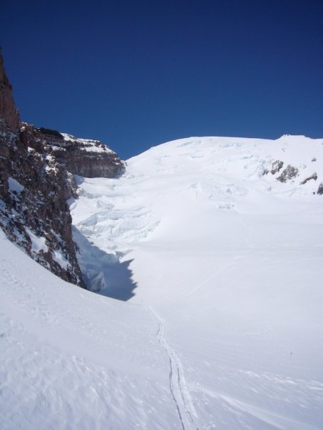
photo- A view of the upper Ingraham glacier from Ingraham flats at 11,100'. photo by Ricardo Contro, 2009.
photo- Zach Taylor ascending the Ingraham glacier. photo by Ricardo Contro, 2009.
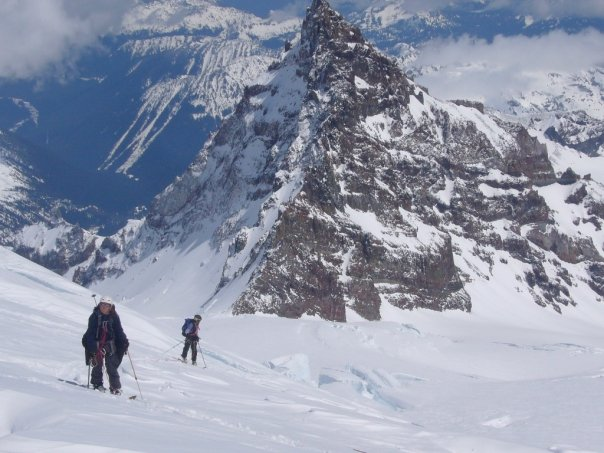
photo- Zach Taylor(foreground) and Mike Bannister(background) on the Ingraham glacier. Little Tahoma Peak 11,138' rises up behind them. photo by Ricardo Contro, 2009.
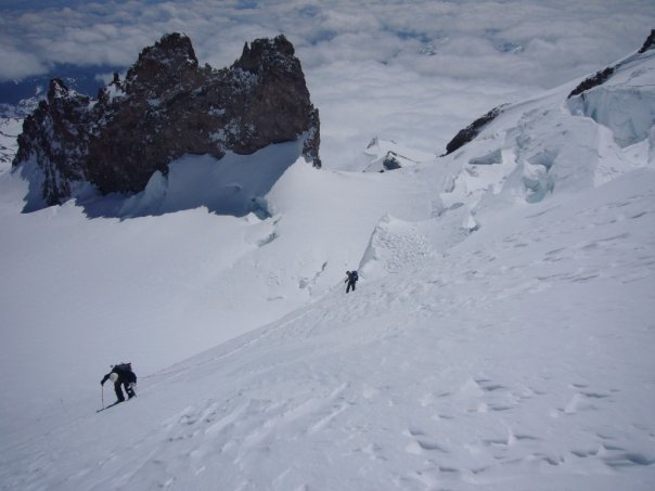
photo-Zach Taylor(left) and Mike Bannister(right) continue up the glacier. Ingraham flats is directly beneath them and the top or Cathedral gap comes up just to lookers left of the rocks in the far upper left view of this picture. photo by Ricardo Contro, 2009.
We made our way down for awhile like this. Finally with the largest crevasses behind us we decided to unrope and finish our ride down to Cathedral gap unroped. This was much easier but also intimidating as I jumped over several narrow but deep crevasses along the way. We regrouped at the top of the gap and rode this section one at a time.
Mike and I decided to rope back up and ski tandem across the Cowlitz glacier. Pollo elected to ski solo. We quickly arrived back at camp Muir. As I clipped out of the rope clouds descended around us and visibility disappeared. As hard as it was to turn around we had made the right decision. Everyone was glad to be there and not on the upper mountain as it began to snow and the wind picked up. We went back into the shelter and began to pack up.
Weather forecasts for the foreseable future were for storms. We did not feel like getting pinned down again for several more days to wait out another storm so we gathered all our gear and readied for the 5,000 vertical foot run from Camp Muir down to Paradise.
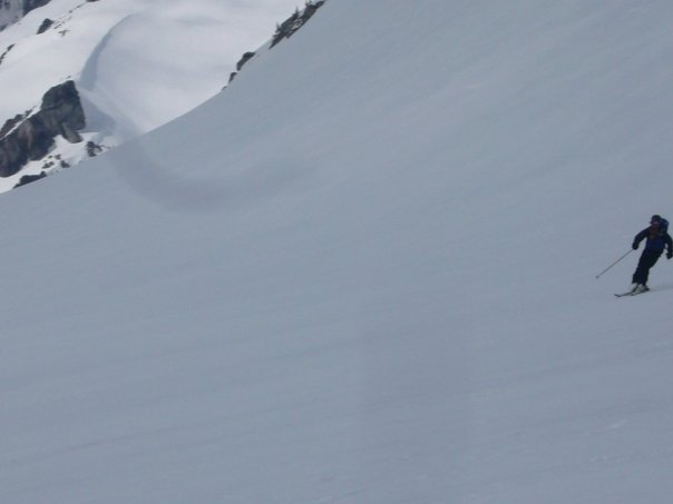
photo-Mike Bannister skiing the Ingraham Glacier. photo by Zach Taylor, 2009.
photo-Mike Bannister descending the Ingraham glacier. photo by Zach Taylor, 2009.
It was snowing and we were in the clouds so finding our way down initially was a bit confusing. If we went too far left we would end up in the lower Cowlitz and if we went to far right the Nisqually, neither was a place we wanted to be. After about 700' or 800' we descended out of the clouds and the lower mountain opened up beneath us. The snow was fantastic. There was alot of powder and soft buttery snow here from the previous days storms.
We flew past several groups of people hiking down making fast turns flying down the glacier. This was one of the coolest runs I have ever taken. We came up on the steep headwall we had skinned up previously. We dropped in making some real quality jump turns and followed the runout down to Paradise and our vehicle.
Rainier was alot of fun even though we did not summit. I will be returning spring of 2010 to summit. We got close to the summit, made good decisions, and enjoyed an incredible 8000'+ run down this mountain.
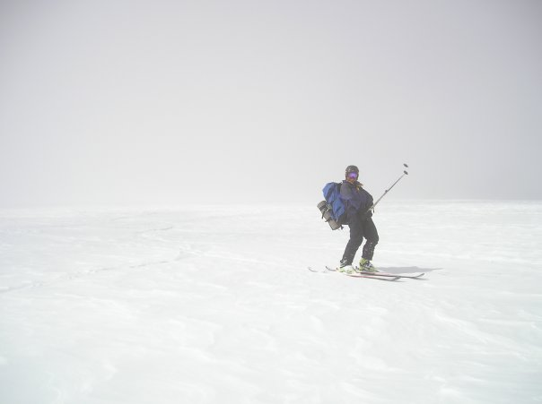
photo-Mike Bannister skiing the Muir snowfield just coming out of the clouds. photo by Zach Taylor, 2009.
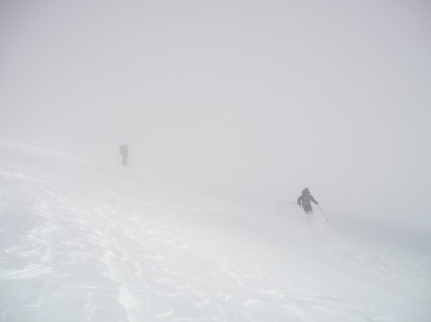
photo- Ricardo Contro(left) and Mike Bannister(right)ski the upper Muir snowfield through the clouds. photo by Zach Taylor, 2009.
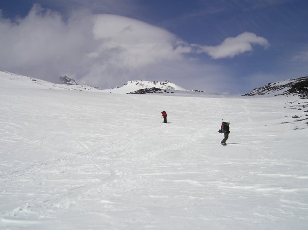
photo- Ricardo Contro(left) and Zach Taylor(right) descend the Muir snowfield. Mount Rainier is obscured in cloud behind. photo by Mike Bannister, 2009.